… read the article about our findings in Masfjorden that was published in Bergens Tidene, the local newspaper, this Monday! That’s a lot of people! The article is behind a pay-wall, but the journalist who wrote it, Atle, kindly allowed me to publish it here for those of you who missed it (and who reads Norwegian), so here it is: Her kan fjordbunnen være i ferd med å dø (Originally published in BT 7/7 2020)
Beautiful – but oxygen poor – Masfjorden
Luckily not everybody who read the article contacted me – but quite a few did; friends that I haven’t seen in ages who congratulating me on messenger, colleagues giving thumbs up on Teams, people writing me to ask if I know anything about the situation in “their” fjord and a few Norwegian scientists that I’ve never met who asked me to send them a copy of the original paper (which is freely available here)… a very positive experience, indeed!
BT and Atle are planning to write more about oxygen and fjords – and I’ve already volunteered to contribute 🙂
They tend to be long and deep, they have one or many sills, they are breathtakingly beautiful and they were carved by ice a long time ago*… I’m off course thinking about the Norwegian fjords! My teaching has brought me back into fjord oceanography (I wrote my Master’s about water mass transformation in a fjord on Svalbard), and last summer I had a little hobby-project trying to figure out how climate change would affect the renewal of the deep water in a fjord… and now that hobby-project is about to get published in “Estuarine, Coastal and Shelf Science”!
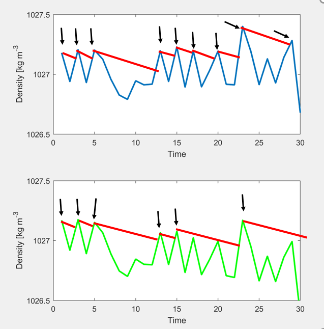
But let’s start from the beginning! Like I wrote in the first line, a fjord has a sill. The sill closes off the deeper part of the fjord basing from the rest of the ocean, and so water in the deep basin is stagnant, i.e. it is cut off from the rest of the ocean.
With time, the density of the basin water will decrease (as turbulence causes lighter water from above to be mixed down). The density of the water outside of the sill (at sill level) varies in time – e.g. because of wind blowing along the coast that pushes the dense water down or lifts it up– and at some point the water outside will be dense enough to flow into the fjord and replace the basin water and the basin water is “re-newed”. How often the deep water is renewed varies greatly between fjord systems – in some fjords the deep water would be stagnant only a couple of weeks while it may be many years between two renewals in others. How long the water stays in the fjord depends mainly on two things: how quickly the density in the fjord decreases (the slope of the red line below) and how variable the density of the coastal waters are (the wiggliness of the blue line). If the density decreases fast, the interval between to renewals will be short, and if the ambient density is very variable, the interval will be longer (on average). If we have information about the density decrease and the density variability for a particular fjord, then we can estimate how long it will be between two renewals (on average) and say something about the probability for very long stagnation period.
Does that matter? Well, fish and other creatures that lives in the fjord consume the oxygen in the water, and the longer the water stays in the fjord the lower the oxygen concentration gets and the tougher it gets for the animals who live there to breathe. So yes, it matters, so fish (and others that care about the environment in the fjord) would want to know if the likelihood of deep water renewal is changing.
The Institute of Marine Research in Norway have hydrographical stations along the coast, that have been collecting salt and temperature data (from which one can calculate density) every other week (roughly) since the 1930s. The data show that the density typically is highest during spring and summer – and that after around 1990 the densest water is becoming less dense (on six out of eight stations). Superimposed on the ambient density variability, we have a negative trend (green line above). The trend is bad news to, for example, the fish living in the fjord basins, since the decreasing trend will increase the length of the stagnation period (fewer black arrows). In Masfjorden, for example, the statistical framework that I develop in my paper suggest that the fish would have to wait (on average) two years longer for new, oxygen rich water and that the risk of stagnation periods longer than 10 years increase by a factor of six.
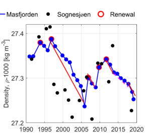
The last deep water renewal** in Masfjorden probably occurred around 2011 (see below), and data from a cruise in June this year show that there has been no renewal so far this year and that oxygen concentrations now are around 2.3 mL/L. Unfortunately, my model cannot predict if there will be a renewal this year, only say something about the probability that the deep water will be renewed.
Density at the bottom of Masfjorden (blue). When the deep water is renewed, the density increase (marked with red circles). From Darelius (2020), Estuarine, Coastal and Shelf Science (Creative common license CC BY 4.0)
* or possibly designed by Slartibartfast?
** There has been partial renewals after 2011, where the upper part of the fjord basin is renewed.
A re-occuring theme on Team Elin is that we like to combine observations, tank experiments and modelling. So this week, Steffi and Mirjam (who both were been instructors on the recent student cruise) went to work on setting up a fjord circulation experiment to complement future student cruises (and to be used in other courses like GEOF105, too).
We now have an experiment that shows how a fresh, yellow inflow (representing the freshwater input into fjords close to their heads by rivers) flows over a initially stagnant pool of salt water. As the freshwater plume flows out of the fjord, it entrains more and more salt water from below, thus thickening and setting up a return flow that brings in more salt water from the reservoir (representing the open ocean) on the right.
We drop dye crystals to visualize the surface current going out of the fjord and the return flow going in, and draw the profiles on the tank to be able to discuss them later.
This experiment is really useful in preparation for a student cruise. Why is it interesting to look at a transect along Masfjorden like we did? Well, because we see in the tank that the freshwater layer should thicken the further away we get from the source. Why did we do the microstructure measurements on either side of, as well as on, the sill? Because there is a huge amount of mixing going on there, just introduced by the tides going back and forth! What would happen if river water was really funneled down to the bottom of the fjord to introduce oxygen to very low oxygen regions? It would introduce a lot of mixing, indeed! All this and more can be seen in this one experiment!
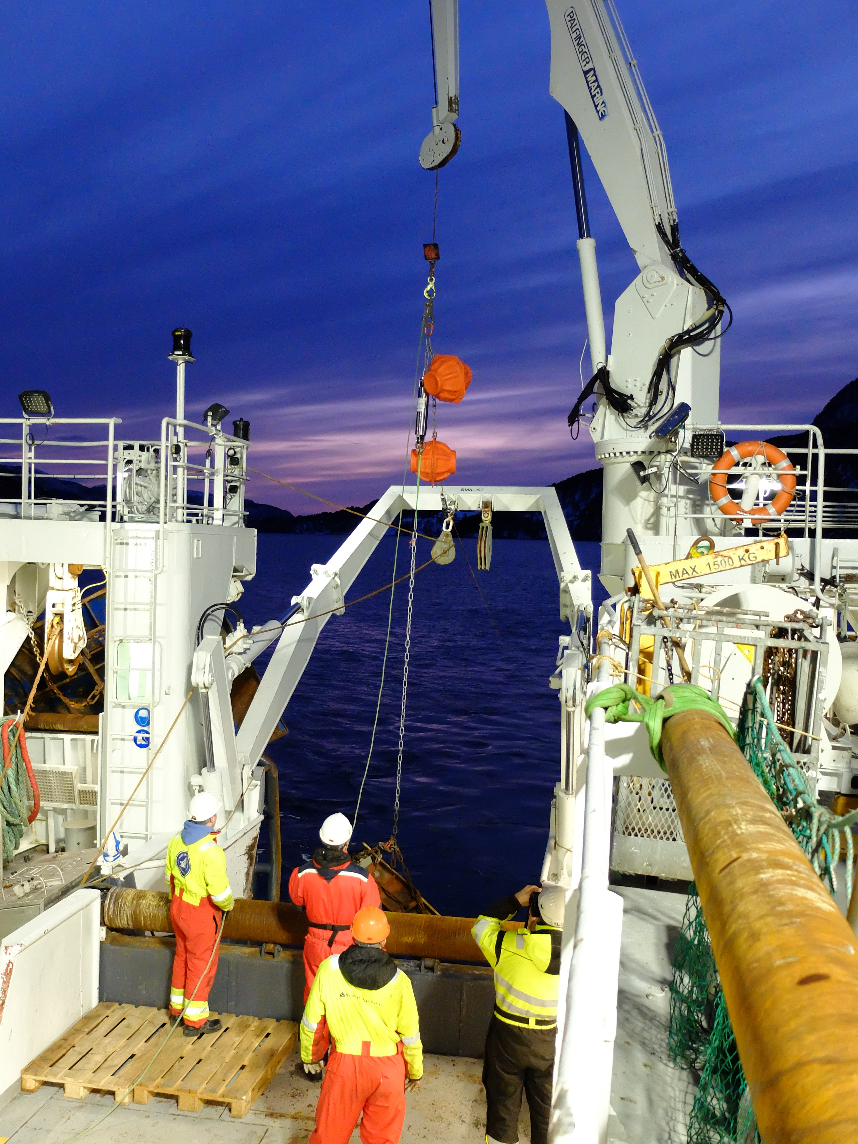
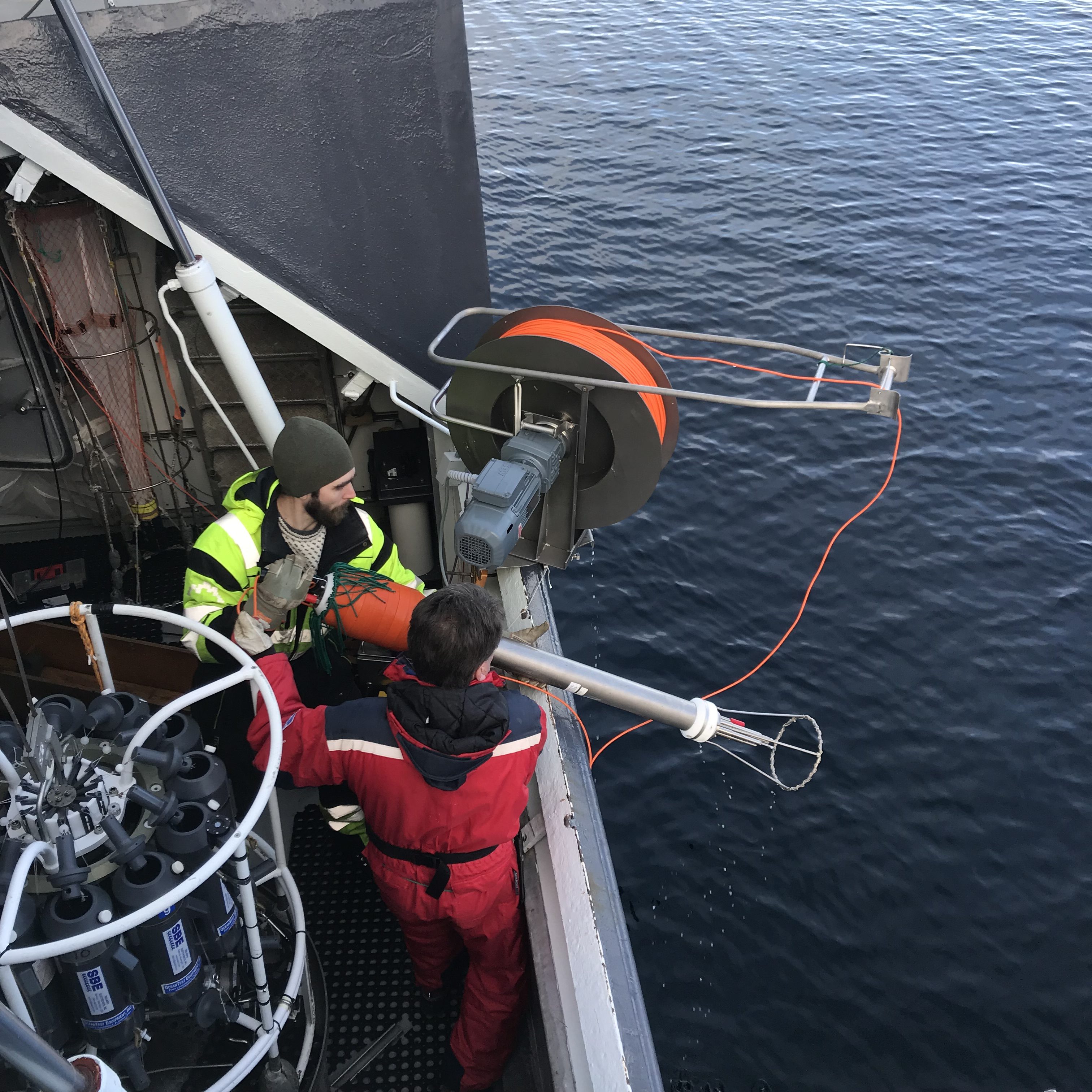
We deploy two moorings in order to keep track of water exchanges over the sill; they will collect data for a year. Instruments recording temperature, salinity, pressure, and velocity are attached to a rope, which is kept in place by an anchor and floating elements. One mooring is anchored on top of the sill (75m), whereas the other one is placed within the first basin at 460m depth.
The mooring is going over board. Train wheels are used as an anchor to keep it secured to the sea floor, the orange floatation spheres will keep it in an upright position while in the sea and bring the instruments back up to the surface when the mooring is released next year
This blogpost is one of a series written originally for our Insta-takeover of @PortalenIGLO, by the awesome night watch team Elina, Helene, Julie, and Sonja. Check out the twitter accounts of Elina and Sonja for updates on what they are doing when they are not at sea with us!
The video showing milk being poured into water is an example of the small-scale process ‘turbulence’. In the ocean, turbulence is important for mixing of different water masses. We measure turbulence with a Micro Structure Sonde (MSS) by letting the instrument fall freely down the water column, recording temperature changes and water movement at a frequency of 1024Hz.
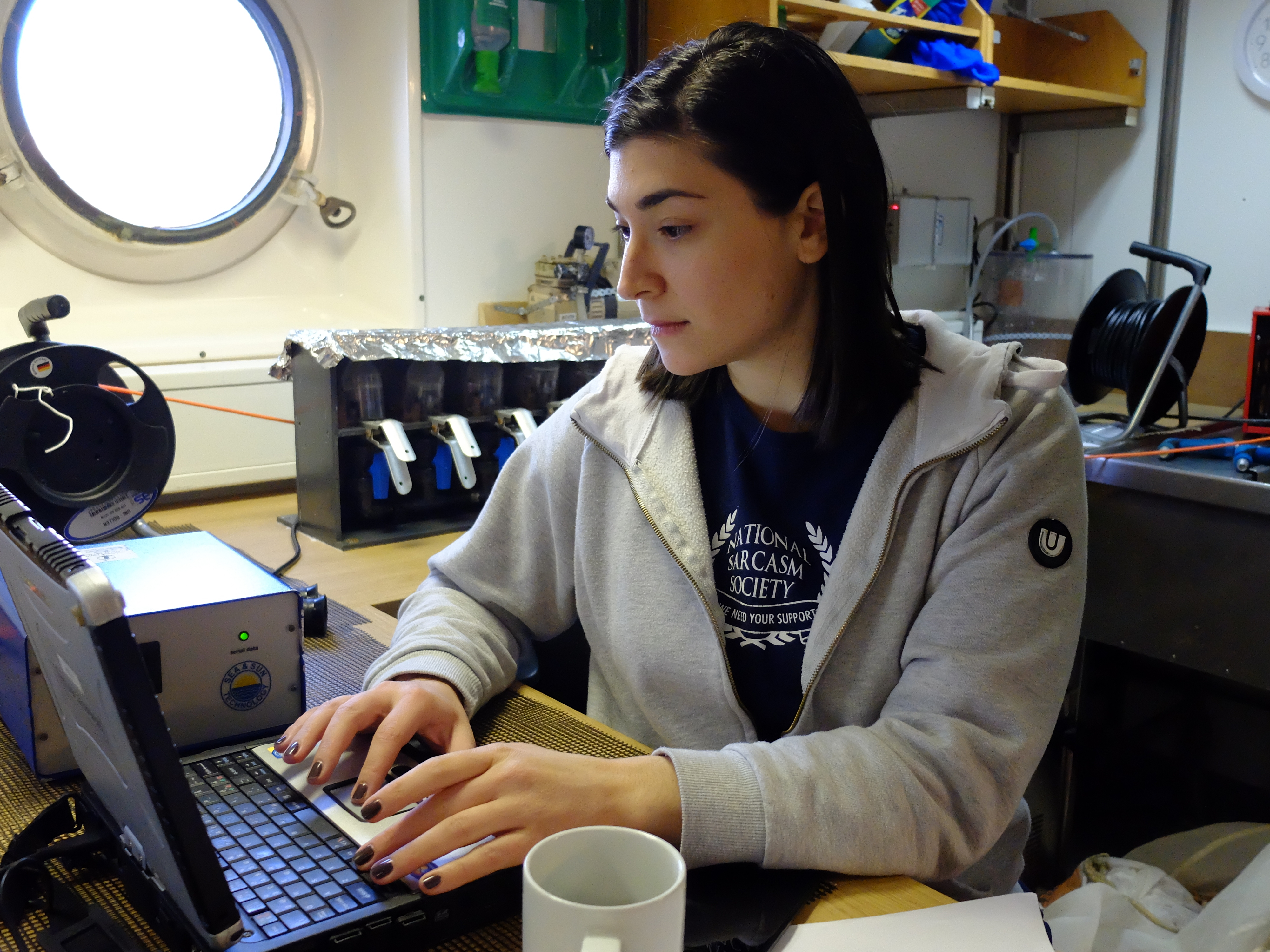
Algot and Arnt Petter are recovering the MSS after a successful measurement of turbulence in the fjordElina is working on the deck unit of the MSS, making sure everything is working well and data is recorded and saved
This blogpost is one of a series written originally for our Insta-takeover of @PortalenIGLO, by the awesome night watch team Elina, Helene, Julie, and Sonja. Check out the twitter accounts of Elina and Sonja for updates on what they are doing when they are not at sea with us!
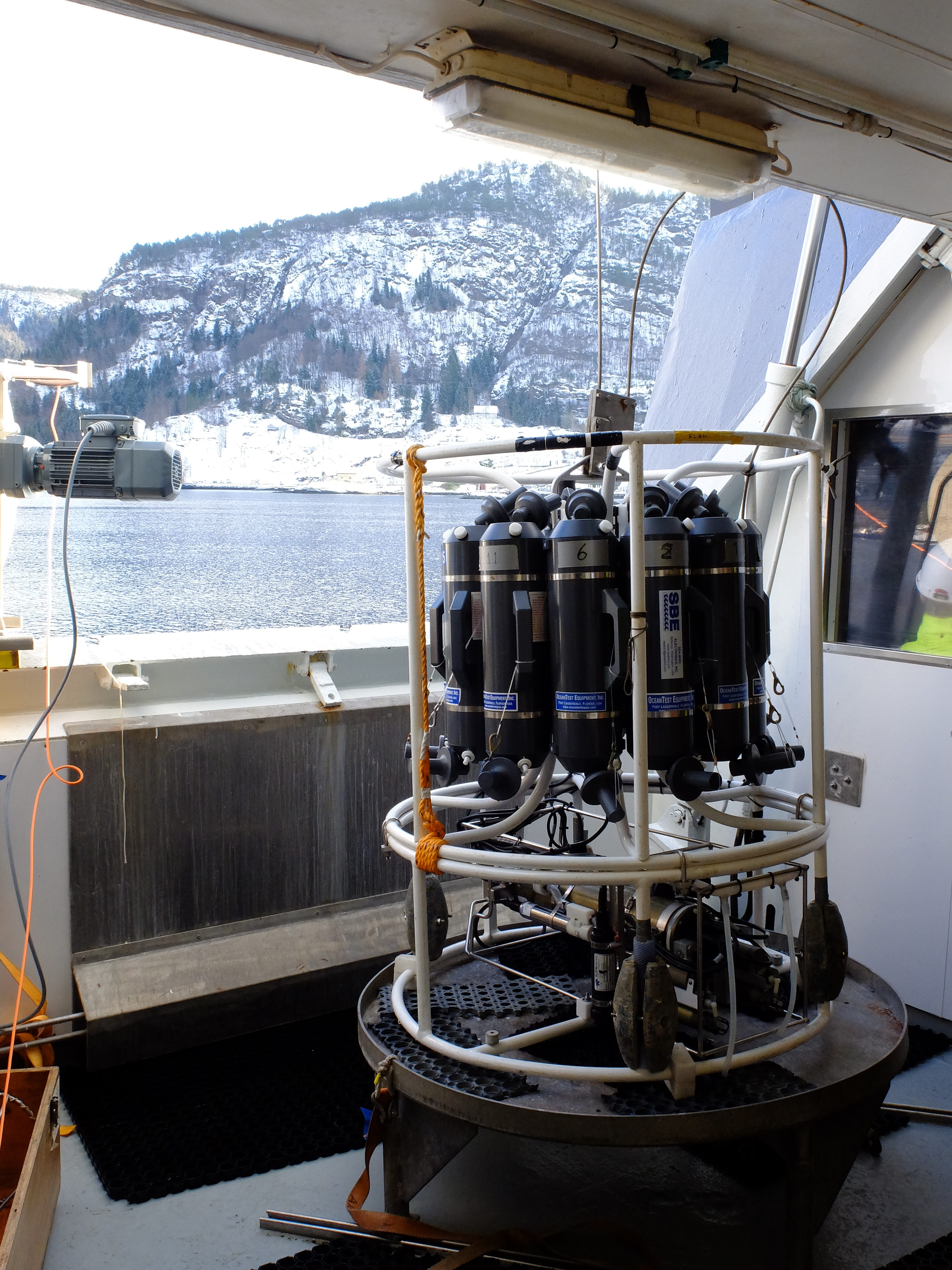
In order to measure the oxygen levels, we lower down an instrument called CTD (as seen in the picture).
A CTD instrument on deck of Kristine Bonnevie, waiting to be deployed into the sea
The CTD measures conductivity (salinity), temperature and depth (pressure). It has grey plastic bottles attached to it, with which we can take water samples at different depths and analyze for oxygen content in the lab.
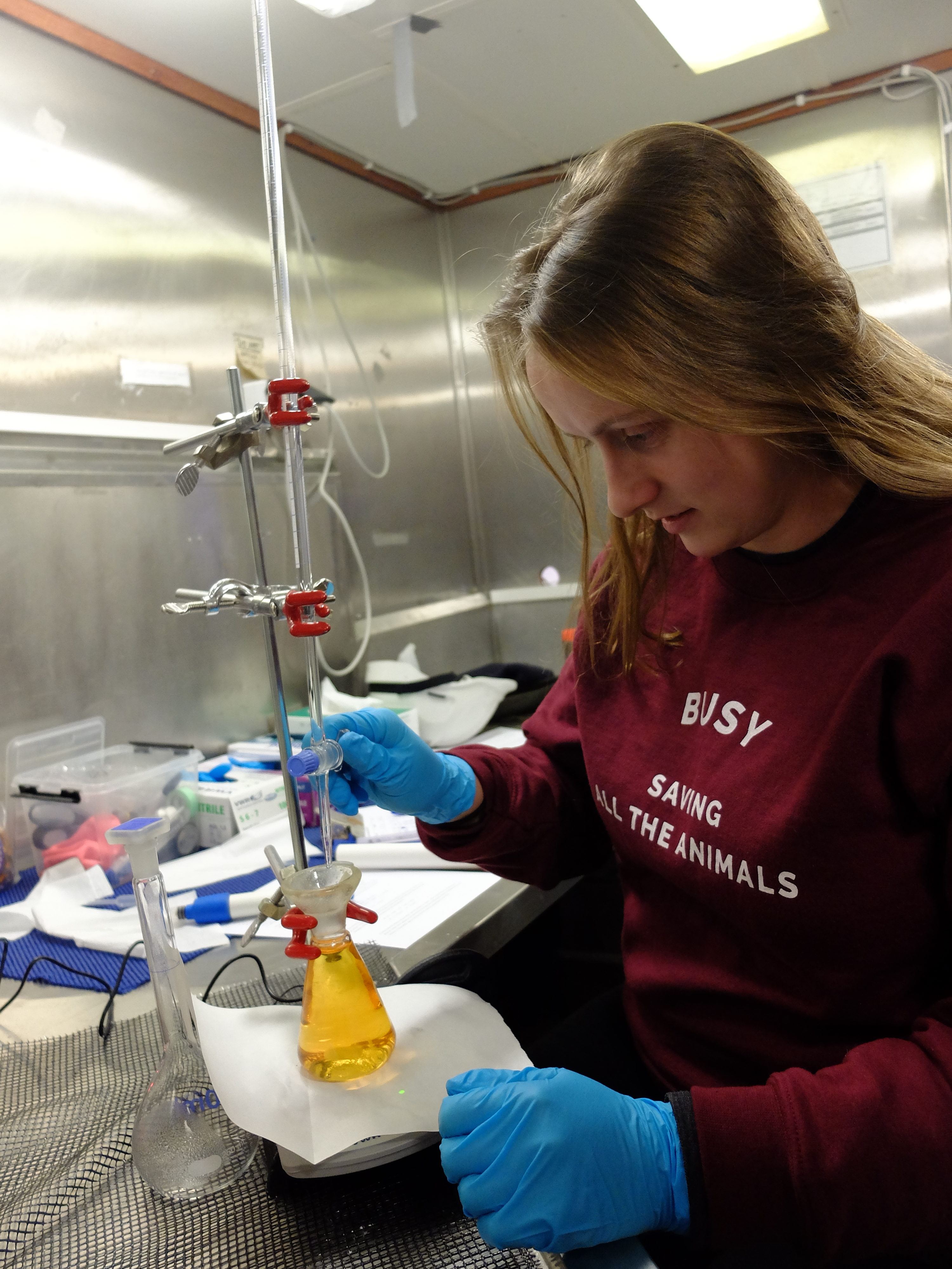
By adding chemicals to the water samples, we bind the oxygen so that we later can calculate the concentration through the titration technique.
Titrating an oxygen sample to measure the oxygen concentration
This blogpost is one of a series written originally for our Insta-takeover of @PortalenIGLO, by the awesome night watch team Elina, Helene, Julie, and Sonja. Check out the twitter accounts of Elina and Sonja for updates on what they are doing when they are not at sea with us!
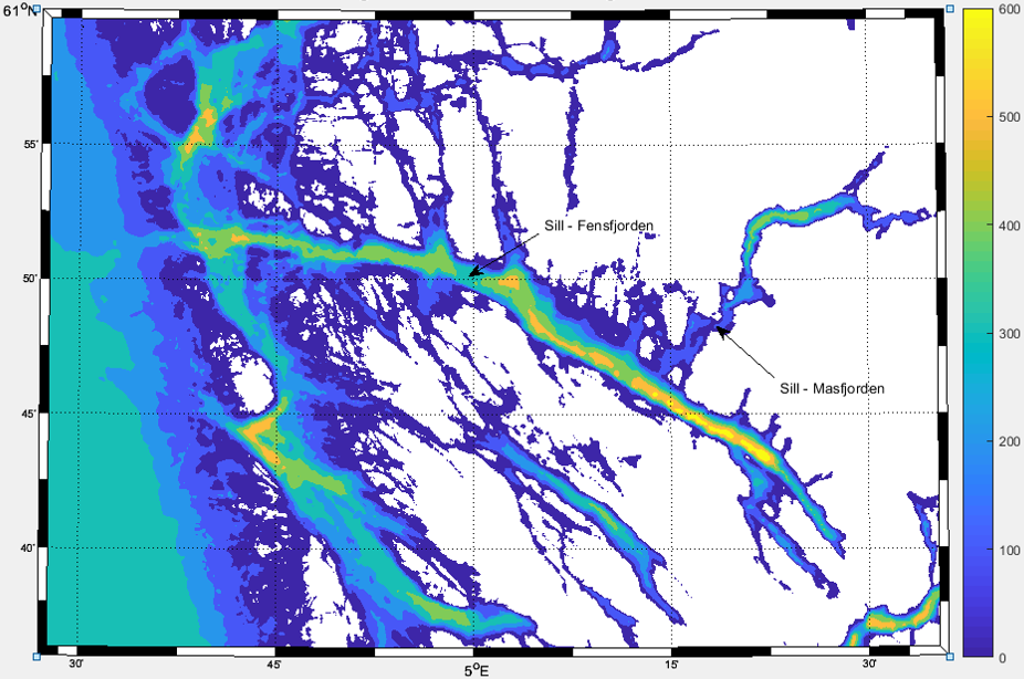
Masfjorden is 24km long, branching out from Fensfjorden. Masfjorden has three sills (a sill is an underwater barrier), which prevent the undisturbed water flow in and out of the fjord. This is why the oxygen levels near the sea floor are particularly low, limiting the marine life as well as decomposition processes. To get new oxygenated water into the basins, dense Atlantic water needs to flow over the sill – this does not happen very often! This week we will study the Masfjorden water masses through a series of measurements.
Map of the bathymetry of Masfjorden and Fensfjorden. The deepest parts are yellow, the shallowest parts are blue.
This blogpost is one of a series written originally for our Insta-takeover of @PortalenIGLO, by the awesome night watch team Elina, Helene, Julie, and Sonja. Check out the twitter accounts of Elina and Sonja for updates on what they are doing when they are not at sea with us!
This blogpost is one of a series written originally for our Insta-takeover of @PortalenIGLO, by the awesome night watch team Elina, Helene, Julie, and Sonja. Check out the twitter accounts of Elina and Sonja for updates on what they are doing when they are not at sea with us!
—
Ahoy from Masfjorden!
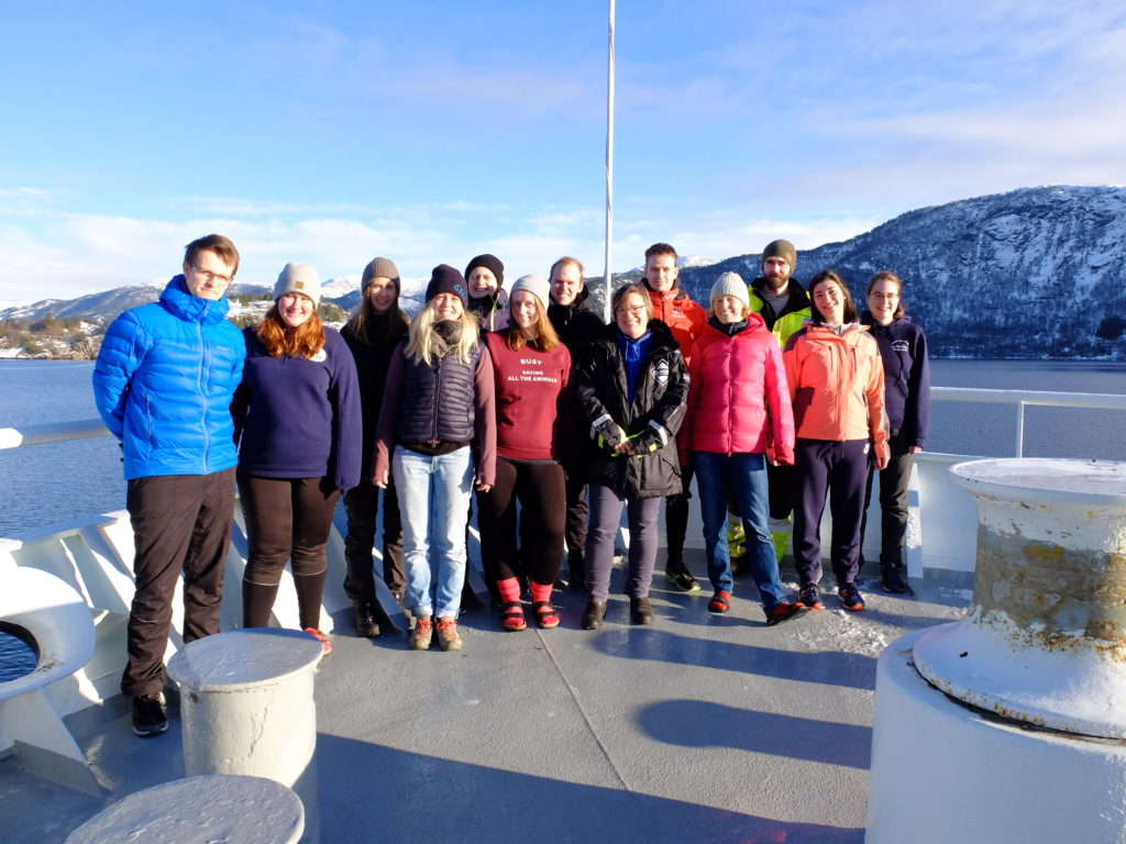
This week we are a group of UiB students going on a cruise, and we are taking over the #portalenIGLO. The ship is called Kristine Bonnevie and is one of IMR’s research vessels. Our study area is mainly Masfjorden, but we are also taking some samples from Fensfjorden, both a five hour journey north of Bergen. This week we will show you what we typically are doing on a fjord-oceanography cruise.