Scrolling back memory lane: Reminiscing of rotation

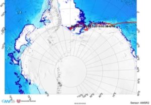
Hei, remember we were in Grenoble and did exciting experiments on the 13-m-dimeter pool on a merry-go-round only last autumn? Feels like a long time ago already. But here are two ways for you to scroll back memory lane:

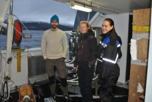
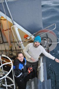
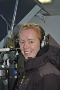
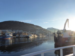
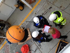
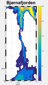
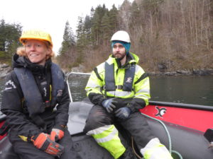
  1. Check out the new way we’ve created to access to Elin & her team’s previous adventures on our “previous adventures” page. Did you know we have posts in English, Norwegian and Swedish, addressing audiences from primary school kids, over high school pupils, to teachers, our fellow oceanographers and friends and family? Quite impressive how much Elin has written over the years, and fascinating to read, too! And also check out her ongoing adventures like the student cruise to Bjørnafjorden!

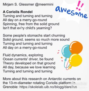
2. Read the award-winning* poem below which I just found somewhere in my files. Yes, we did feel not quiiiite well when we were working on the platform at high rotation rates, but we still loved the whole experience, every minute of it! 🙂

*Yes, this poem really won an award in a competition run by @IAmSciComm on Twitter back in October. And here is the awesome bag and sea horse card we won 🙂

Polarstern in the Weddell Sea

I’m still in the Bjørnafjord doing one last section before we head back to Bergen – but I just had a report from Svein Østerhus and Polarstern. They are now just north of the front of the Ronne Ice shelf in the Weddell Sea.

Polarstern in the Weddell Sea.

Scientist from British Antarctic Survey are onboard with “Boaty McBoatface” – an unmanned, autonomous (i.e. not attached to a cable) submarine with sensors for just about everything onboard – that they plan to send on a mission beneath the Ronne ice shelf! Truly exciting!!! I’d love to be there…

While being in the vicinity of the ice shelf front, Svein will deploy a couple of temperature recording LoTUS bouys  (see previous post)  within the ice shelf front polynya* for me. These will remain five years at the bottom before surfacing… so be patient!


*a polynya is an area within otherwise ice covered water. Tidal currents and wind typically keep the area just in front of the ice shelf front ice free during summer, and often also during winter.


Trying out triangulation!

A new day in the Bjørnafjord with the fjord oceanography students from GFI has begun – and we decided to check in on one of our moorings. The moorings are equipped with an “acoustic release”, a unit which we can communicate with using acoustic signals. Normally we only talk to it to tell it to release the anchor and come up to the surface, but you can also use it to find out where the mooring actually is… and that was what was on the schedule this morning.

Waiting for the ship to get in position (Algot, Vår and Carola)

The captain made three stops around the position where we let go of the anchor, and at each position we lowered a transducer down into the water and asked the release to tell us how far away it is*. There was some confusion about what codes to actually use (sorry Kristin for waking you up!), but once we got the right one the release responded promptly!

Transducer going down!
Is there anyone out there? Vår listening for the acoustic release to respond


With three positions and three distances you can draw three circles – and if all is well they ought to cross each other in one location… which is where your mooring is! This time it was well and safe were we thought it was – which is good, because the captain had already reported the position to the navy who will do submarine training here in the weeks to come!

*what actually happens is that the deck unit measures the time it takes between emitting a signal and receiving a response, and knowing the speed of sound in the water you can calculate the distance.

To the Bjørnafjord with students from GFI!

You don’t have to go all the way to Antarctica to do exciting oceanographic fieldwork! This week I’m lucky enough to bring a bunch of enthusiastic students out on Krisitin Bonnevie to explore the fjord “Bjørnafjorden” just South of Bergen. Many of them have never been at sea before, but a week of CTD’s and moorings and they are ready to go just about anywhere!

Leaving Bergen for Bjørnafjorden (Photo: Carola Detring)

One of the aims of the cruise is too try to solve the puzzle with the mysterious tidal currents in Lukksundet… Lukksundet is a narrow strait connecting the Bjørnafjord to the Hardangerfjord in the south. The tidal currents are very strong here – nothing strange with that – what’s strange is that they turn every two hours!

Discussing mooring design (photo: Carola Detring)

The tides along the coast of Norway are semi-diurnal; there are two high tides and two low tides a day. We’d expect the tidal currents to have the same periodicity (i.e. to change direction every sixth hour), but to be shifted in time so that maximum tidal currents occur in between high and low tides. Obviously, something more complicated is happening in Lukksundet! I’ve got an hypothesis about what is going on… do you?

Map over Lukksundet, with the Bjørnafjord in the north and the Hardangfjord in the south.

The students have deployed moorings within and around the strait, and hopefully we’ll be able to resolve the riddle when we retrieve the data on another student cruise to the fjord a month from now!

On our way to deploy a tidal gauge in Lukksundet (Poto: Carola Detring)

The students have posted photos and a film from the cruise here!


A birthday present from the Weddell Sea!

Amongst the facebook birthday wishes in my inbox I also found this perculiar Message:

Transmit Time: 2018-02-02T13:41:59Z UTC

Iridium Latitude: -77.0799

Iridium Longitude: -33.8234

Data: 2c31362c54454d50313030302c323031372d30312d30312030303a30303a30362c36302c393534302c333630302c2d312e3837312c333233392c332c3630382e33342c3630352e39312c31312e30322c76322e362e382c31363031383b…

which means that at least one of the LoTUS buoys that I deployed last year did what it was told and surfaced today!

A LoTUS buoy waiting to be deployed

LoTUS stands for “Long Term Underwater Sensing” and it is a bottomlander that you more or less through over the side of the ship. It sinks to the bottom, where it measures the tempearture until it is programmed to let og of its weight and come to the surface. Once at the surface, it transmits the data back to us in the office via satellite. Very nice!

The number in the Message above are as in-understandable to me as they are to you – but hopefully the instrument devellopers from KTH will be able to transform them into understandable data… a one year long temperature record from a location just north of the Filchner Ice Shelf front in the Weddell Sea! There was one more buoy that was programmed to come up today and which didn’t yet report home – so keep your finger’s crossed!

A collegaue of mine, Svein Østerhus, is currently onboard Polarstern in the Weddell Sea, and he will deploy more of these buoys for me later during the cruise!

Below are a few Pictures from the LoTUS buoy deployment last year:

Sorting out the ropes…
Waiting for the ship to be in the right position… (I’m in black and yellow)
… and off it goes!