Looking for some easy ocean experiments? You just found them!

Today is the first day of my (Mirjam’s) “24 days of #KitchenOceanography” advent calendar. This year not only in English and German, but also in Norwegian and Portuguese!

A huge thanks to Jacob for his amazing work translating & prettifying & adding to & posting the calendar on GFI’s web pages & social media (Facebook, Instagram and Twitter)!

Dead water

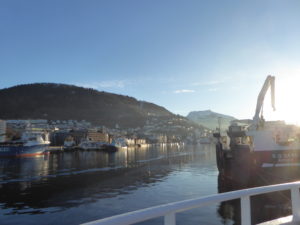
 (by: Torunn Sandven Sagen, Petter Ekrem, Eirik Nordgård)

In 1893, during the Fram expedition, Fridtjof Nansen and his crew encountered a phenomenon where the velocity of the ship was reduced significantly, even though the engine was working at full speed. Nansen described this phenomenon as “dead water” (Brady, 2014). This dead water effect can happen when the ship creates an internal wave as it moves through water. The water must be stratified, meaning that the top layer is less dense than the bottom layer. At the same time, the draught of the ship must have the same depth as the top layer. The internal wave produces a drag, reducing the velocity of the ship. The speed of the wave is only dependent of densities and depth of the layers, not the velocity of the ship. (Grue, 2018).

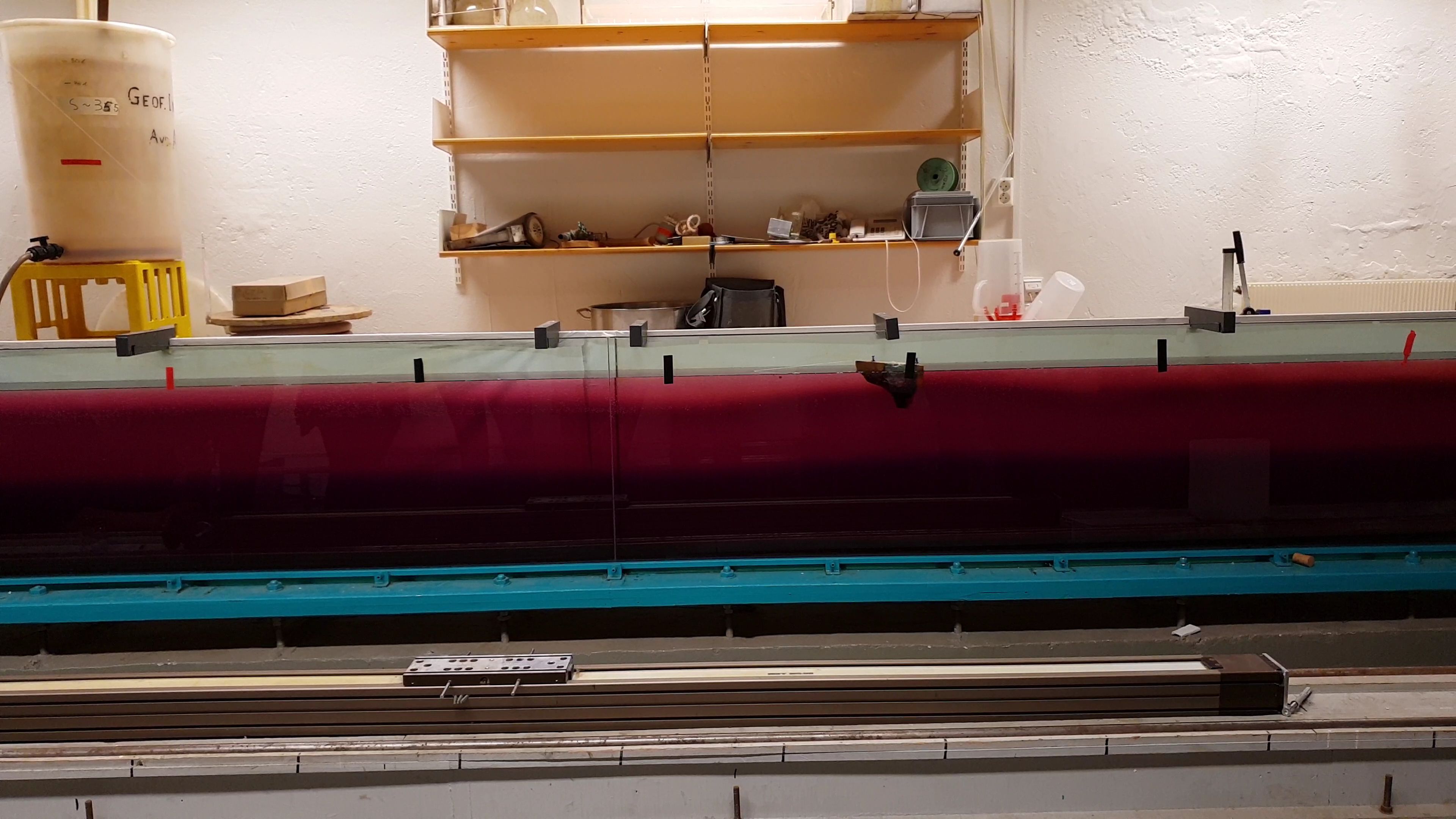
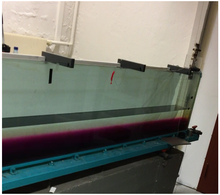
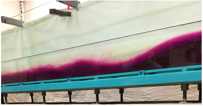
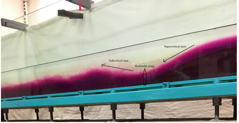
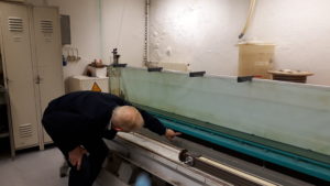
We performed an experiment (as seen in the video) where we recreated the ocean conditions and created an internal wave. Then we explored how and when the internal wave could influence the velocity of the ship. To simulate the conditions Nansen experienced, a wooden boat was pulled with constant force across a tank filled with water. The water had two layers, one fresh layer on top (clear), and one saline underneath (purple). The depth of the saline layer must be much greater than the depth of the fresh layer.

The experiment was performed several times with the boat being pulled with constant, but different, force. We expect that if the speed of the boat is larger than the speed of the internal wave, the boat will not feel the wave because it moves faster than the internal wave. If the speed of the boat is smaller than the speed of the internal wave (as seen in the video), the wave will catch up with the boat, and the speed of the boat will be much reduced.

Hydraulic jump

(by Cristina Arumi Planas, Elise Madeleine Colette Brunet, Haley Okun)

In order to observe Lee Waves and their related phenomenon, an experiment was conducted in a large water tank with a stratified two layer system. The two layer system was constructed with fresh water sitting atop colder salt water. The fresh water had a salinity of about 0‰, with a density of 1000 kg/m3 while the pink-dyed salt water had a salinity of about 35‰, and a density of 1028 kg/m3. In order to force Lee Waves to propagate, a mountain was moved along the bottom at two different speeds, fast and slow. While conducting an experiment to visualize Lee Waves, the phenomenon of the hydraulic jump can be observed. This event can be visualized when water flows over rocks or even in one’s kitchen sink. This occurs when water flowing over a surface goes from subcritical to supercritical, which is calculated through the Froude number. To calculate this, the velocity of the flow is divided by the phase speed of the shallow water gravity waves. The square root of this fraction is then taken to provide a unitless value called the Froude number. The result is either greater than one (supercritical) or less than one (subcritical). Supercritical Froude numbers indicate that waves cannot propagate upstream. This can physically be visualized when the flow over the observed surface goes from smooth and rather thin, to turbulent and rough. As we pushed the mountains through the stratified water, the denser saltwater (shown with pink dye) was forced up and over the mountain, resulting in turbulent motion just behind the surface anomaly. As the thinner flowing water moved from the downhill slope of the mountain to just downstream and onto the bottom of the tank, the flow went from smooth to rather chaotic. The interface where the flow becomes turbulent is the hydraulic jump. The smoother water flowing over the mountain is supercritical while the more mixed water just downstream is the subcritical flow. When the mountain was moved at the faster speed, this hydraulic jump was shifted accordingly. Instead of the hydraulic jump occurring just behind the mountain, the waves seemed to lag with the more turbulent flow occurring farther downstream than with the slower mountain speed.

Lee waves

(by: Jori Neteland-Kyte, Sara Elisabeth Holen Sælen , Susanne Moen Olsen)

Lee waves are a type of internal gravity waves, which is generated as fluid moves over an obstacle. The fluid needs to be stably stratified for this to occur. These waves can occur in both the atmosphere and in the ocean. (Cushman-Roisin and Beckers, 2011, page 412) To show this phenomenon it is convenient to perform a simple experiment, where a long tank is used. The tank is filled with stratified water, the bottom layer is denser than the layer above. A purple color is added to the denser water at the bottom layer, as seen in Figure 1.  This is done to distinguish between the two layers. The tank is also equipped with a moving obstacle which is possible to move at different constant velocities across the bottom of the tank.

Figure 1:The initial state of the two-layered stratified fluid.

When the obstacle is moved across the tank, waves are generated in the interface between the layers as seen in the figure 2.

Figure 2:Wave are generated when the obstacle is moved with the lowest speed.

Figure 3. displays how the Lee waves propagates, with the positions for the supercritical area, the hydraulic jump and subcritical area marked by the arrows. The supercritical area is positioned directly above the moving obstacle, which appears as one smooth wave. In the transition between the supercritical and the subcritical area, the hydraulic jump is found. This occurs at the end of the descending side of the moving obstacle. Following behind the
hydraulic jump is the subcritical area, this is where a train of waves are generated. These waves decays with time.

Figure 3: Position of sub- and super critical flow and the hydrualic jump.


Long time no seen…

There hasn’t been much happening on this blog lately, since I’ve been busy, busy, busy teaching geophysical fluid dynamics to the third year bachelor students here at GFI. My job description as an associate professor at UiB includes 50% teaching – however giving the (somewhat equation heavy) course for the first time it felt more like 150%… but now the last lecture is given, the students are happily (?) preparing for the exam, and I finally have time to do some science… and to update the blog!

First I’ll have the students tell and show you what they did with Mirjam when she was visiting the Bjerknes centre and Bergen in October. One flight of stairs down from my office, in the basement of GFI, there is a 6 m long tank. It is not round and it is not rotating (like the tank in Grenoble), but it can move mountains! Or rather, it holds a mountain that can be moved. Why would one want to move a mountain in a tank? Well, as Arne Foldvik, the professor emiritus who built the tank a few decades ago realized, if you want to study flow over topography in the lab, then it is easier to have the fluid move beneath the fluid than to make the fluid move over the mountain… and the physics are the same.

Arne (who later left the lab and became on of the Norwegian pioneers in Antarctic oceanography) spent years with the tank – my student only spent an hour but they did some really nice stuff! Thank you again Mirjam for setting it all up – and thanks to the students for handing in the (non-compluslory) assignments that you’ll be able to read (and watch) in the days to come!

Below you see Arne Foldvik showing off his results – and inspecting his old tank.

Arne Foldvik inspecting his tank
All Arne’s experiments were documented by GFI’s in house (!) photographer!
Detailed logbooks…


Recovering moorings in Bjørnafjorden with students

Do you remember our student cruise in the fjords south of Bergen some weeks ago? We brought students on the ship Kristin Bonnevie to deploy moorings and take CTD measurements (read about it here: https://elindarelius.no/2018/02/07/to-the-bjornafjord-with-students-from-gfi/).
Last week, we returned to Bjørnafjorden with Bachelor students on board of Kristin Bonnevie to recover the moorings and take more CTD sections. All four moorings were recovered smoothly and successfully without any loss, which made us very happy! During the whole cruise, the students took CTD measurements, also with miniCTDs, for which they had to drive out with a little boat to get into more shallow areas. The student definitely returned from the cruise with a lot of data to work with.

Recovery of moorings in Bjørnafjorden during a student cruise. Moorings are arrays of instruments that are brought to the see floor by heavy weights. A release and floating elements are used to bring the instruments back to the surface.
With this little boat, we went further into the fjords in shallower areas to take measurements with miniCTDs.


Trying out triangulation!

A new day in the Bjørnafjord with the fjord oceanography students from GFI has begun – and we decided to check in on one of our moorings. The moorings are equipped with an “acoustic release”, a unit which we can communicate with using acoustic signals. Normally we only talk to it to tell it to release the anchor and come up to the surface, but you can also use it to find out where the mooring actually is… and that was what was on the schedule this morning.

Waiting for the ship to get in position (Algot, Vår and Carola)

The captain made three stops around the position where we let go of the anchor, and at each position we lowered a transducer down into the water and asked the release to tell us how far away it is*. There was some confusion about what codes to actually use (sorry Kristin for waking you up!), but once we got the right one the release responded promptly!

Transducer going down!
Is there anyone out there? Vår listening for the acoustic release to respond


With three positions and three distances you can draw three circles – and if all is well they ought to cross each other in one location… which is where your mooring is! This time it was well and safe were we thought it was – which is good, because the captain had already reported the position to the navy who will do submarine training here in the weeks to come!

*what actually happens is that the deck unit measures the time it takes between emitting a signal and receiving a response, and knowing the speed of sound in the water you can calculate the distance.

To the Bjørnafjord with students from GFI!

You don’t have to go all the way to Antarctica to do exciting oceanographic fieldwork! This week I’m lucky enough to bring a bunch of enthusiastic students out on Krisitin Bonnevie to explore the fjord “Bjørnafjorden” just South of Bergen. Many of them have never been at sea before, but a week of CTD’s and moorings and they are ready to go just about anywhere!

Leaving Bergen for Bjørnafjorden (Photo: Carola Detring)

One of the aims of the cruise is too try to solve the puzzle with the mysterious tidal currents in Lukksundet… Lukksundet is a narrow strait connecting the Bjørnafjord to the Hardangerfjord in the south. The tidal currents are very strong here – nothing strange with that – what’s strange is that they turn every two hours!

Discussing mooring design (photo: Carola Detring)

The tides along the coast of Norway are semi-diurnal; there are two high tides and two low tides a day. We’d expect the tidal currents to have the same periodicity (i.e. to change direction every sixth hour), but to be shifted in time so that maximum tidal currents occur in between high and low tides. Obviously, something more complicated is happening in Lukksundet! I’ve got an hypothesis about what is going on… do you?

Map over Lukksundet, with the Bjørnafjord in the north and the Hardangfjord in the south.

The students have deployed moorings within and around the strait, and hopefully we’ll be able to resolve the riddle when we retrieve the data on another student cruise to the fjord a month from now!

On our way to deploy a tidal gauge in Lukksundet (Poto: Carola Detring)

The students have posted photos and a film from the cruise here!