The daily life on RV Kronprins Haakon during the transit

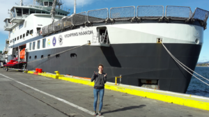
Finally, we have reached our study area in Dronning Maud Land. Since we left Punta Arenas 10 days ago, we have been sailing non-stop through the Southern Ocean. You may wonder what we have been doing the whole day on board?

First of all, our instruments and gears were piled up in huge containers and had to be unloaded. Labs had to be prepared and packed into plastic to avoid contamination, bottles had to be sorted and all equipment had to be stored securely to not fly around ones we hit high waves. The group leaders used the transit time to plan our tracks in more detail, decide where to take samples and where to do measurements. Some of us already started taking measurements during the transit!

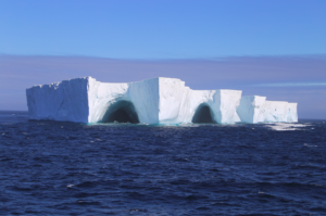
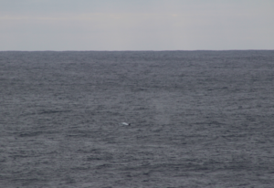
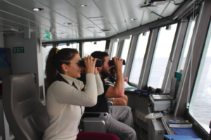
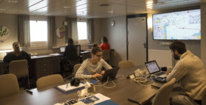
Otherwise the days are quite similar to home when we work on our computers, just that once in a while someone shouts: Iceberg! Whale! Or, watch that beautiful petrel outside! Of course, we also have to take time to clean our own workspace and do the laundry.

Scientists working hard during the transit on Kronprins Haakon. Photo: Anne Helene Tandberg, UiB

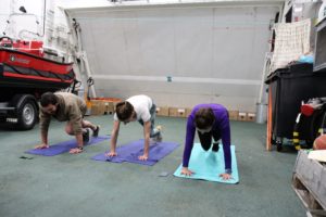
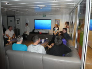
Before we went on board, most people didn’t know each other, and now we have to share the cabin with another person. You better hope for someone who is not snoring! However, we already made new friends and spend some time with social activities. On Fridays it’s quiz-night, on Saturdays we play twister, every evening after dinner we do HIIT on the Helideck and we watch movies together, play table tennis, basketball etc…. The work at the stations will work much better if we know each other well!

Workout on the Helideck. The waves make the training extra difficult. Photo: John Olav Vinje
Quiz-evening with all scientists and crew-members! Photo: John Olav Vinje

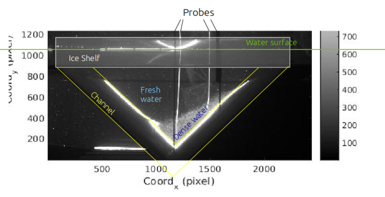
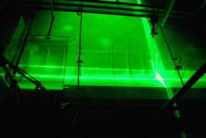
Now, we have finally deployed a Seaglider (Autonomous Underwater Vehicle) and took the first CTD (Conductivity-temperature-depth) section, which was our first station. You will soon hear more about that and other work on board!

BTW, there is also more about our adventure on the UiB webpage!

Beautiful icebergs!

Huge iceberg that we passed on the 3rd of March. Photo: Karoline Viberg

Look at this beautiful iceberg that we passed during our transect to Dronning Maud Land! In Antarctica, icebergs of very different size and shape calve off ice shelves or marine terminating glaciers frequently. Did you know that the largest iceberg  that has ever calved off was 11000 km² big? It is called B15 and broke off the Ross Ice Shelf in 2000. More recently in July 2017, the iceberg A68 with 5800 km² disintegrated from Larsen C in the Antarctic Peninsula. In the Figure below you can see that icebergs from the Antarctic Peninsula drift northward and enter the Antarctic Circumpolar Current –entering our track to Dronning Maud Land.

This plots shows modeled trajectories of icebergs for 1997-2008. Class 5 is the biggest iceberg type and they travel very far! (from Rackow et al., 2017)

Observing icebergs and their drift trajectories on satellites is important to avoid collisions with ships, but scientists also study them because they interact with the surrounding ocean and influence the ecosystem. Surface winds push sea ice towards the iceberg on one side and away from them on the lee side, where a so-called polynya (ice-free area) develops. This has a strong influence on biological productivity and ventilation of the ocean. In addition, iceberg melt increases phytoplankton growth and sea ice growth due to the strengthened stratification. Very big icebergs such as B15 and A68 are studied because they destabilize the grounded ice and accelerate ice loss into the ocean. Why do they break off in the first place, what do they do to the grounded ice? Also, how does the underlying ecosystem react to the sudden income of sunlight after many centuries of darkness? All these questions are important for the Southern Ocean, but very little studied. It is not our aim to study the impact of icebergs, but we still need knowledge about it, because the icebergs have such a big influence on the surrounding water.

Today we passed by B15, which has traveled since 2000 all the way from the Ross Ice Shelf to the Weddell Sea. It has lost big parts of it on the way, but it is still very big. We were waiting outside with our cameras ready to take pictures of it, but unfortunately it was too foggy to see anything. That was too bad…

Observing whales on the way south

After a delayed departure, we are rapidly heading towards the Drake Passage and into the Antarctic Circumpolar Current to reach our measurement area. The captain is giving his best and keeps a velocity of 9-10kn (instead of the 8kn that we expected). Maybe we’ll catch up! You can follow our track at http://havstraum.no/dml where you can also see our stations and satellite images.

Until we are at the first station, people are preparing their labs and observations are going on. The observers have the best spot on the ship and get a lot of company up there. We have already seen a lot of birds, whales, dolphins, penguins etc!

It is difficult to take good pictures of the whales and dolphins, because they only show up very shortly. The shaking ship doesn’t really help either…But here I got a sei whale in front of the lens! I hope there will be better pictures coming.
Spotting birds and whales

Going on board of RV Kronprins Haakon

Finally the ship has arrived and we could check in to our cabins! It is beautiful with big windows, meeting rooms, many labs, gym, sauna, hottop, great views and so far a lot of containers with instruments standing around. We are still sorting out all the equipment and getting it in place. The plan is to leave today after lunch (we are 4h behind Norwegian time), so cross the fingers we’ll manage. So far we are already one day delayed because the ship had to leave to pier the whole day on monday, but the mood is good and everyone is amazed by how efficient the crew is working. Let’s hope we can leave soon!

Going on board of RV Kronprins Haakon

Waiting for the ship

Yesterday after arriving in Punta Arenas, I took Maudy with me to check out the ocean and to look for RV Kronprins Haakon. It was nice to get some fresh air after a 28h travel, but we couldn’t spot the ship yet. We’ll have to wait a bit longer, so in the meanwhile I will go kayaking. See you soon!

Maudy and me waiting for the ship to arrive.


Why do we do this cruise?

… obviously because we want to gain more scientific knowledge about the ocean in Dronning Maud Land – both about the biodiversity (fish, mammals, plankton, benthos) and the physical aspects (water masses, currents, sea ice).
However, there is also a political reason behind it. Antarctica is nobodies land and divided into territories from different nations. To avoid exploitation of the land and the Southern Ocean, an Antarctic Treaty was signed in 1959 by the 12 nations that were scientifically active. Today, it consists of 53 parties. Within the Antarctic Treaty, there is a Convention on the Conservation of Antarctic Marine Living Resources, that started in 2008 to regulate fisheries in Antarctica and to adopt Marine Protected Areas (MPA). It is part of the global objective of UN Convention on Biological Diversity to protect 10% of coastal & marine areas by 2020.
The biggest MPA today is in the Ross Sea in Antarctica. Further MPAs are under development, but are not consensus yet. One of the discussed MPAs is in the Weddell Sea and partly contains Dronning Maud Land, under Norwegian claim. A science-based management is crucial for the planning of the extent and conditions of the MPA, which is the reason for why we are going there with people from different scientific backgrounds.

A new adventure to Antarctica

Only a few days left until I am taking off to Punta Arenas in Chile from where I will take you on a new science adventure. Me– that’s Nadine, Elin’s PhD student, I will be on the ocean for seven weeks and explore Dronning Maud Land, the Norwegian territory in Antarctica, together with scientists from different marine science disciplines. The area is far away from any civilization and the transit from Punta Arenas takes about 11 days. At the moment, I am arranging the last details for the travel and the suitcase is slowly filling up. What’s in there? A warm working suit, safety shoes, gloves, hand warmers, sea sickness medicine, chocolate, an ebook reader stuffed with books, movies, a camera, my computer and most important, Maudy my mascot! The instruments that we’ll use are already sent down, among them a mooring (long chain of instruments) that will be anchored at the ocean floor in front of Fimbul ice shelf. In two years, we will hopefully be able to get back there to pick up the instruments full of data that tell us what influences ice shelf melt, ocean currents, changes in water masses with time and much more. The other scientists on board will be looking at sea ice, mammals, fish, benthos, zooplankton and micronekton. What this all is? To be honest, I am not so sure myself, but I have a lot of time to find out and I will keep you posted. You can follow my stories about the area, the measurements, the life on board here or on twitter (@DareliusElin) and facebook (EDarelius&Team) during the next weeks. Hopefully there will be some nice pictures of penguins and ice bergs!

Antarctica map with the research area marked with the ship. We will sail from Punta Arenas in Chile and back to Cape Town in South Africa.

Introducing: Thomas Valran and Samuel Viboud

We have presented all the scientists that are involved in the project, but still haven’t introduced the two most important people: Samuel and Thomas without whom we would not have been able to conduct the experiments.

Today, part 2: Samuel Viboud, for Thomas see here.

Samuel is an engineer in experimental techniques on large instruments and has been working at LEGI since 2001, when it was still at another place in Grenoble where Elin, Anna and Adrian conducted experiments about 10 years ago. To be in charge of the rebuild of the Coriolis platform was the most exciting event for him. Samuel is the technical director of the Coriolis platform and the head of the mechanical department at LEGI. Thanks to his creativity, technical know-how and sense for innovation, he received the well-deserved “Médailles de cristal” from CRNS in 2015.
About his personal life he says:
“Coming from a winemaker family who cultivates the grape varietal: “Mondeuse”, I live in the village of Apremont in Savoie, and do not hesitate to spend my time with work such as harvesting and bottling. In my personal life that I share with my wife and my 2 children, the exchange, the attention and the mutual support are daily. Concerning leisure, I am passionate about sport and particularly about road cycling. I regularly climb the mountain passes of the region and commute 100km to work by bike. The mountains are also my playground especially in winter, with ski touring that I like to share with my friends. What characterizes me in the end in life as at work are the essential values such as: sharing, conviviality and family.”


Introducing: Thomas Valran and Samuel Viboud

We have presented all the scientists that are involved in the project, but still haven’t introduced the two most important people: Samuel and Thomas without whom we would not have been able to conduct the experiments.

Today, part 1: Thomas Valran.
Part 2 to follow on Monday

Thomas is an engineer at the Coriolis platform and has been working for LEGI since March 2016. During his diploma in industrial engineering at the “Ecole nationale supérieure des Mines de Saint-Etienne” he worked as apprentice engineer for Schneider Electric. At the Coriolis platform, the most exciting part for him is to work for many different projects that never make the job boring. Due to his experience in climbing he moves on the supports of the platform very gently despite the high rotation speed. In his spare time, Thomas likes to go on road trips with his motorcycle or help at his parent’s farm where he grew up and where there are about 100 cows to take care of.

How salt changes the current

Until the beginning of the week we had only conducted barotropic experiments. This means that we induced fresh water into fresh water. How boring, you may thing… Well, although these experiments were very interesting, you are probably right because this setup doesn’t quite correspond to reality. At the coast of Antarctica, dense water is on one side produced by the growth of sea ice and on the other side origins from deep water that spills over the coast onto the continental shelf. Because the continental shelf slopes down towards the ice shelf, the dense water reaches towards the ice shelf. Our aim is to find out how the water behaves as it reaches the ice shelf front.

To reproduce this dense water flow, we inject salt enriched water into the channel. This relatively dense water approaches the ice shelf front along the left channel slope. To see a clear boundary between the dense and the fresh water, only a density difference of 1 kg/m3 is needed. The density difference increases the velocity of the current a lot, so that the experiments last much shorter. While the barotropic current was mainly blocked by the ice shelf front, the baroclinic current can freely enter the cavity beneath the ice shelf, as the dense water is largely decoupled from the freshwater. Because the fresh water layer above the dense current is barotropic, the previous experiments were of big interest as well to see how the upper layer behaves as the current reaches the ice shelf front.

On the cross section through the channel, the dense water separates clearly from the freshwater. It flows parallel to the slope to its left. Because we built a wall at the end of the channel (see our previous post: https://elindarelius.no/2017/10/20/closing-off-our-channel-at-the-ice-shelf-end-to-avoid-unrealistic-outflow/), the channel fills up quickly with salt water, which we have to evacuate after each experiment.

The dense, saline water contains many particles and gets visible in the vertical laser sheet. It flows towards the ice shelf (=towards us) along the slope to its left side.

In the photo of the cross section, you can also see 4 probes sticking in the water that we use to measure the density close to the source and close to the ice shelf front. We can then calculate the velocity of the dense current and the mixing between the fresh water and dense water along the channel.

In this experiment, we injected a flow that is 1kg/m3 denser than the ambient water. During the scans, the vertical laser shows the position of the dense current and the 4 probes (2 in front of the ice shelf front, 2 in front of the vertical laser) measure the change in density with time.