
You might have heard on the news a few weeks ago that a large iceberg
broke off from the Brunt Ice Shelf, in the Weddell Sea. If you follow
the “Antarctic” news – and have a good memory – you might also remember
that a few years ago (2016), the UK research station Halley, that used
to be situated on what is now an iceberg, had to evacuate scientists and
personnel and move the relatively newly built station as the crack
suddenly started propagating faster than anyone expected. Halley is the
only research station that I know about which is built on skis, so it
was “simply” pulled to a new, safe location on the other side of the
crack!
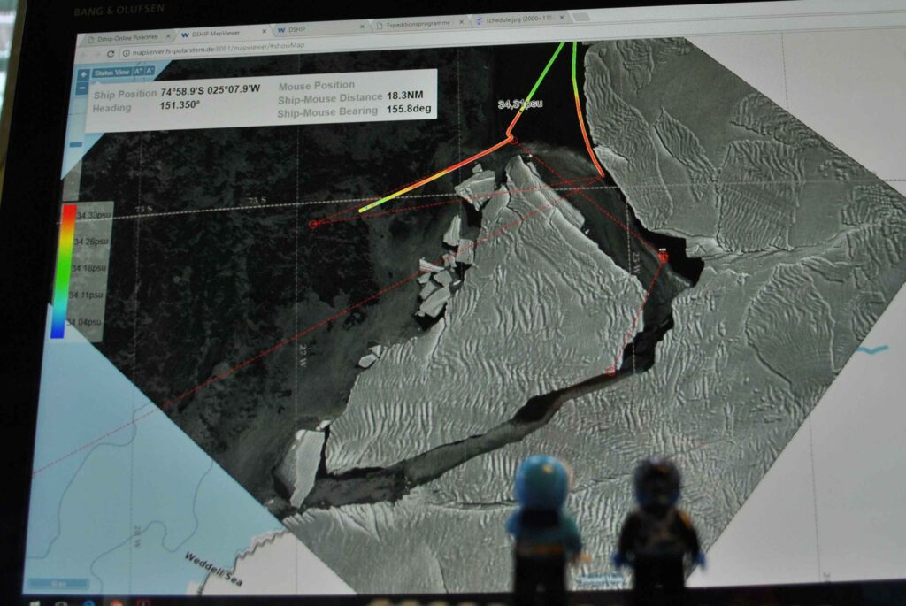
Anyway – the iceberg, which got the official name A74, finally broke
off, and it has now drifted a couple of nautical miles away from the
remaining iceshelf, leaving a “canyon” between the shelf and the iceberg
that is wide enough for Polarstern to enter. The scientists studying the
ocean floor – benthic ecosystems and sediments – where very eager to get
there to sample what was until recently a sub-iceshelf (and thus very
difficult to access) system.
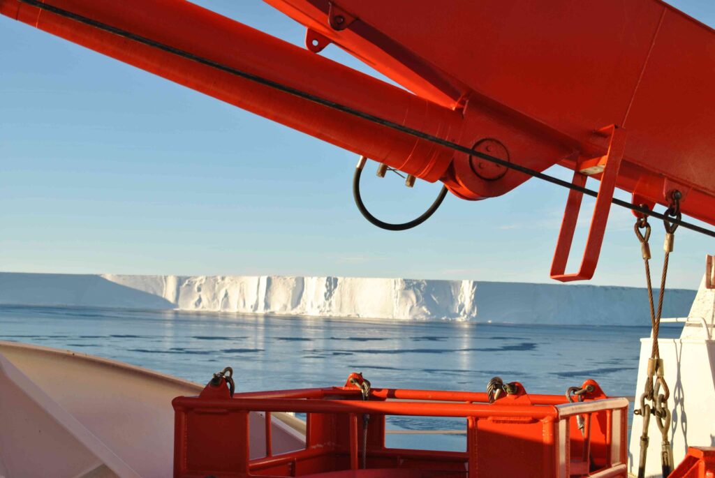
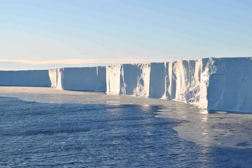
We were all excited about circumnavigating A74, and to enter what we
quickly named the “Grand Canyon” – and most of us have followed the
motion of the iceberg on the satellite pictures that we receive every so
often. Is the “canyon” widening or shrinking? Are there smaller icebergs
blocking the passage? Can we get through? The sun, which we haven’t seen
much of during this expedition, obviously were just as excited as we
were, because it decided to join us for most of the day in the canyon
offering a spectacular view of the glittering bluish ice walls around
us!
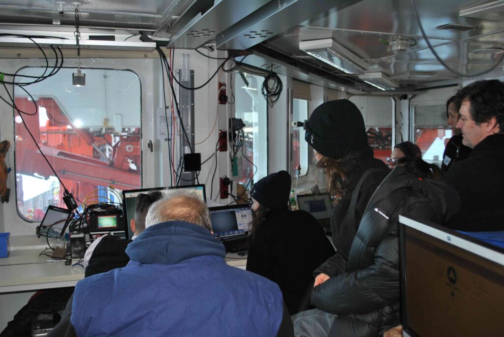
We got to do three stations in the “canyon” – with intensive sampling of
both the water column and the bottom sediments. The AWI OFOBS team sent
down their camera system, and we could watch the ocean floor beneath us
live on their screens. To me, a non-biologist who are just about able to
distinguish a fish from a sponge it looked mostly like the open ocean
stations we’ve occupied earlier, but to the experts, things were
apparently different. Hopefully they get to repeat the station in the
years to come, to study how the community evolves now that it no-longer
has an ice shelf roof over its heads.
The CTD-profiles we made in the “canyon” all looked more or less the
same – a straight line from surface to bottom (i.e. close to constant
salinity and temperature). Supercooled Ice shelf water (a lighter
version than what we find in the Filchner Trough) was flowing out of the
Brunt ice shelf cavity, and the formation of buoyant ice crystals at
depth were clearly visible in the images from the OFOBS team! The ice
crystals had also clearly aggregated on the “geo-bio-chemical-lander*”
line, which were deployed for about 8 hours at one of the stations. When
the lander was recovered, there was a 1 cm thick layer of ice on the
line!
*a big thing full of instruments (for bio-geo-chemical process studies)
that looks like something that would land on the moon.