
Kjersti, Steffi, Elin and myself (Mirjam) recently discussed ways to better integrate the GEOF105 student cruise into the course. My suggestion was to ask the students to observe things throughout the whole duration of the course, and then have them relate their time series with what they observe when “at sea”. In this mini series tagged #BergenWaveWatching, I write up a couple of suggestions I have for observations that are easy and fun to make. I am anticipating that my suggestions will be strongly biased towards #wavewatching, so if you have any other suggestions, I am all ears! 🙂
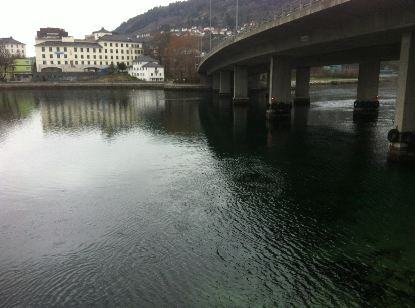
Really close to home today! Nygårdsbruen.
Where to go
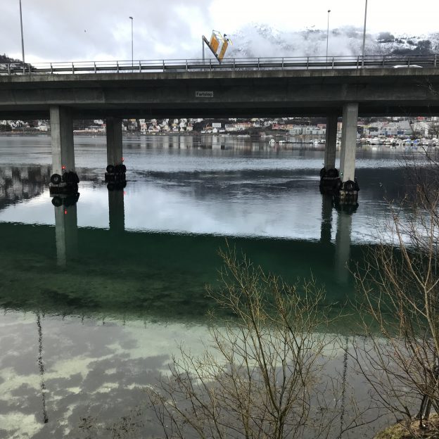
Nygårdsbruen — the bridge right next to GFI
When to go
Whenever you are going to or leaving GFI anyway works fine, especially if that happens to be at around the same time every day
What to look out for
That kind of depends on how regularly you will realistically be able to go there. If you are there several times per week, you could look at the tidal current. Which direction is it going in, how strong is it, what’s the water level like, …?
If you aren’t going as often, maybe focus more on a general description of what is going on. Is there a tidal current visible? Is it going in or out? Does it have an influence on the wave field? What other factors influence the wave field? What’s the wind direction? Can you see areas that are sheltered from the wind and areas where the wave field is more developed? Can you easily look into the water? Where, and where not? Why is that? That kind of stuff.
What to do with the data
By “data”, I mean the collection of pictures on your smartphone. You could, for example, relate them (thanks to the phone’s time stamp on the pictures) to time before/after high water as I did in this post for tides on the Elbe river in Germany. This of course doesn’t account for the spring/neap signal, which you might want to include.
Questions that I find interesting: When is the strongest current actually happening relative to high water, and within the spring/neap cycle? In what way do ingoing and outgoing currents differ (and why? Shape of the landscape? Different gradients in the water level? …)?
Or, if you don’t have a lot of data from different days, describe what you see (maybe similarly to what I did here).
How this is relevant for the student cruise
One task on the GEOF105 student cruise is relating trajectories of drifters to several factors. The wind field on that day, for example, but also the tidal currents in byfjorden. So having a good intuitive understanding of tides makes interpreting the drifters’ trajectories a lot easier, even though the drifters will be deployed in a different area.
More generally, this suggestion is about repeatedly observing a very easily accessible body of water and looking at how it looks different each time. This is good practice of observational skills, and also eye-opening to the many ways in which a body of water can look different at different times — different times in the tidal cycle, different seasons, different weather, especially different winds.
Do you have suggestions for us? What other spots or topics would you recommend in and around Bergen to be added to the #BergenWaveWatching list? Please leave a comment! We are always looking to expand this list!
2 thoughts on “#BergenWaveWatching: observing waves and tides on Storelungeren”
Comments are closed.